Attractions around the area

Wilsons Promontory

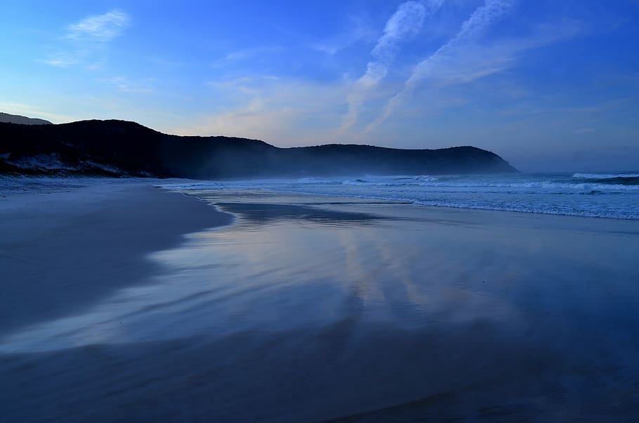
Wilsons Prom, the southernmost tip of mainland Australia. Walk remote coastal bushland trails and swim at pristine beaches dominated by granite tors. Hike to a more secluded campsite. Either way, the local wombats, kangaroos and emus are waiting to meet you.

Swim at Norman Beach – just a few minutes’ walk from Tidal River Campground, or go snorkelling for a unique underwater view of Victoria’s largest marine national park. 

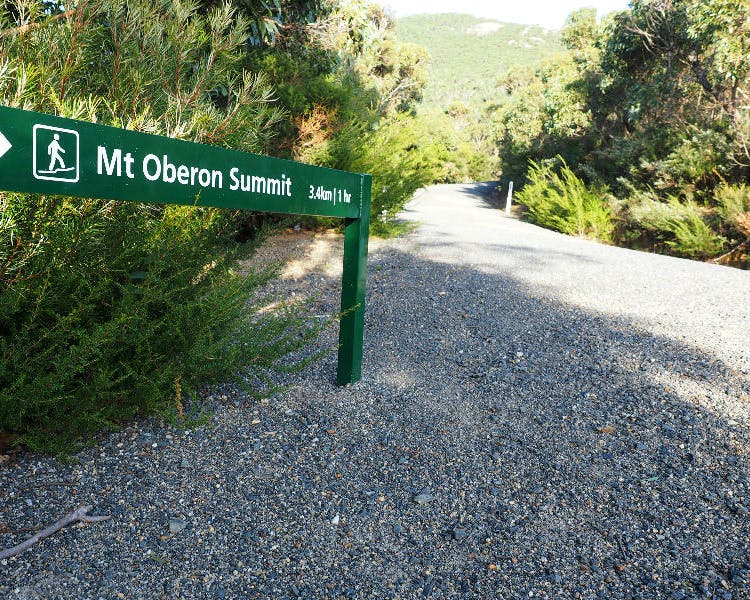
Scale the granite peaks of Mount Bishop or Mount Oberon for panoramic views, or enjoy an overnight hike in The Prom. In the north there’s a remote and rugged wilderness to explore, while the south is home to the historic Wilsons Promontory Lightstation and Sealers Cove.

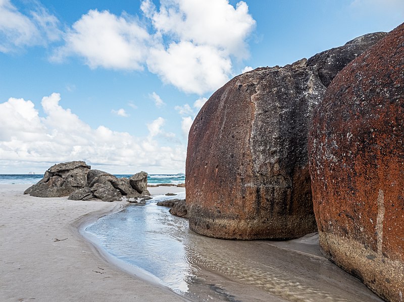
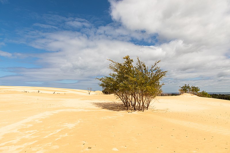
Feel the sand between your toes at some of the more secluded beaches of Wilsons Prom, from Cotters Beach to Whisky Bay and Fairy Cove. Check out Big Drift, an impressive inland sand dune system, one of the Prom’s well kept secrets. 

Mt Oberon

Mount Oberon offers one of the best views in Victoria. Trek to the summit overlooking Tidal River and enjoy a 360-degree panorama of Wilsons Promontory. See unrivalled views of the Prom’s spectacular landscape, from its pristine coastline and beautiful offshore islands, to its lush gullies and magnificent mountains.

SHORT WALKS. (from Tidal River)

Loo-Errn Track (1km)
Squeaky Beach Track (2.1km)
Squeaky Beach Via Picnic Bay (2.5km)
Pillar Point (1.8km)
Tidal Overlook (1.9km)
Tidal Overlook Circuit (3.8km)
Lilly Pilly Link Track (1km)
Lilly Pilly Gully Nature Walk (2.6km)
Lilly Pilly Gully Circuit (5.8km)
Mt Bishop Track (3.7km)
Picnic Bay to Whisky Bay (700m)
South Norman Beach, Norman Point, Little Oberon Bay (4.1km)

DAY WALKS.

Darby River to Tongue Point (3.8km)
Darby Saddle To Tongue Point Walk (5.6km)
Darby River, Fairy Cove, Tongue Point, Darby Saddle Walk (9.4km)
Norman Beach, Tidal Overlook, Squeaky Beach, Picnic Bay, Whisky Bay (6km)
Mount Oberon Summit (3.4km)
Telegraph Saddle to Tidal River, via Oberon Bay (16.9km)
Sealers Cove (9.5km)

Squeaky Beach

The famous white sand of Squeaky Beach is so named because of the noise it makes when you stroll along it. Enclosed by impressive granite boulders at either end of the beach, park locally or walk here from neighbouring Picnic Bay or Tidal River.

The Big Drift

Escape the crowds who flock to the southern Prom with a walk out to the Big Drift, a series of ever-changing inland sand dunes. This other-worldly landscape reveals a very different side to Wilsons Prom and is a short walk from Stockyards Camp, just by the park entrance.

Agnes Falls

Agnes River rises below Beech Hill in state forestry area within the Strzelecki Ranges, and flows generally south in a highly meandering course, before reaching its mouth in Corner Inlet of Bass Strait, southeast of the town of Toora in the South Gippsland Shire. The river descends 570 metres (1,870 ft) over its course. The Agnes River sub-catchment area is managed by the West Gippsland Catchment Management Authority. The river is traversed by the South Gippsland Highway between Toora and Welshpool.

Waratah Bay

Waratah Bay The Waratah Bay is located in south Gippsland, Victoria. The bay is an arc of almost 20 kilometres of flat sandy beach framed by Cape Liptrap to the west and Wilsons Promontory in the east.